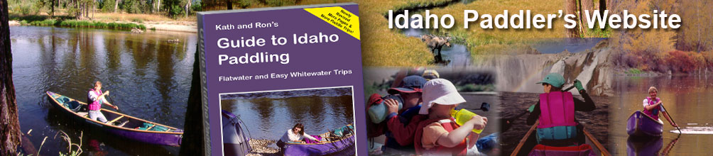
Welcome to the Idaho Paddler's Website! This website was created to supplement the book Guide to Idaho Paddling.
On this website, you'll find updated information on Idaho rivers. We'll include changes to rivers that might have occurred since the latest edition of the book was published. From time to time, we'll add new paddling trips - and for folks in Northern Idaho, we've added much more to the paddling summaries included in the book.
We can use your help. If you come across changes: new access points, new or altered diversions, new bridges or possible river dangers, drop us a line and we'll post the information here. Our email address is paddling@grc101.com.
River Updates/Changes | New Paddle Trips | North ID River Maps
Also if you're a pack rafter here's some info: Pack Rafting Information
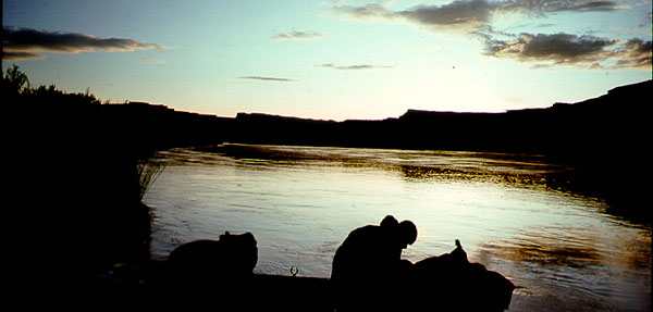
Here is the beta . . .
.
Page numbers are from the revised edition of Guide to Idaho Paddling. Rivers, below, are listed alphabetically.
.
Bear River (pages 31-48). New Flow Website. Flow information on all parts of the Bear River is now easier to access. You can find it at: Bear River Basin
Billingsley Creek Paddle (page 147). Pipe removed. Within 1 mile from the put-in, a pipe crosses the river which requires a short portage. We mentioned in the book that the pipe might be removed in the future. In fact, it has been removed which means that you no longer have to worry about the portage.
Blackfoot River (Special Management Area) (page 49). Put-in improved. Take-out change. Thanks to Shannon Clemens Syrstad for updated information on the Blackfoot River. She wrote to tell us that the put-in (bridge on Diamond Creek Road) has a new gravel landing on river right and you no longer have to lift your boat over a fence. Shannon noted that "hundreds of conifers have been added to the river banks for bank stabilization, sediment straining, pool creation and fish habitat. It also adds more challenge to the route I would say due to paying attention and staying away from the banks. Most strainers were off to the side, but a couple were mid river."
Also, note that the take-out described in the book just above the weir now has no trespassing signs. Shannon said that they altered the take-out location by pulling "the canoe upstream a little and taking out right at the forest service boundary sign where the bank was the shortest/closest to the road. A good pull out was right across the road for loading/parking."
Boise River - All Segments (pages 205-231). Great Resources. Several changes have occurred to the Boise River since the most recent version of Guide to Idaho Paddling was printed. Those are noted in the next couple of bolded sections, but in addition, Kath and I wanted to tell you about two excellent resources that go beyond what we have done.
First, there's Tom Chel's Boise River Water Trail. Tom first created this guide in the mid 1990's, and in subsequent years, revised it a number of times. Here's a link to the last version that he created: Tom Chel's Boise River Water Trail (6th Edition).
Adam Bass has built on Tom's work and has authored a full color guide to the Boise River. The waterproof, spiral-bound guide is available from outdoor stores or on-line from the Boise River Enhancement Network. Adam's guide follows Tom's naming and numbering system. It's called the Boise River Water Trail Guidebook - 8th Edition. Tom's and Adam's works are invaluable resources, particularly if you are planning to paddle some of the less popular stretches of the river.
Boise River - Ann Morrsion to Glenwood Bridge (page 213). New boat access point for drift boats. Some time after we went to print on the latest edition to Idaho Paddling, a new boat ramp was completed for Boise River users. The advantage of the ramp is that it provides a place where drift boaters can launch.
It is located at the Willow Lane Athletic Complex. The complex can be reached in a number of ways, but if you are coming from downtown Boise, drive out State Street toward Eagle. Slightly less than 3 miles from the Capitol Building, look for Willow Lane. Take a left there and another left into the Willow Lane Athletic Complex. Drive past the parking area for athletic fields until reaching the parking area near the river.
The take-out is Westmoreland Park as we have described in Guide to Idaho Paddling. There's no ramp there, but it's not too difficult to hoist a drift boat out. Distance-wise, it's a short run, only slightly more than 2 miles from the new boat ramp to Westmoreland. Still, it's adequate distance if you're fishing along the way.
Boise River Below Glenwood Bridge (pages 209-216). Additional Information Available. As we noted above, if you are paddling any of the Boise River stretches below the Glenwood Bridge, we highly recommend Tom Chel's and Adam Bass's guides.
Buffalo River (pages 104 - 106). Road improved. The forest service road to the put-in no longer requires high clearance vehicles and is easily accessible by most vehicles. Note that this road is now numbered 219, not 1219 as shown on the map and in the text.
Henry's Fork of the Snake - Harriman Park Area (pages 115 - 118). Correction for river access point. The take-out and put-in for the Harriman stretches is incorrectly marked on the map on page 116. The correct location of the take-out and put-in is the boat ramp above the Old Osborne Bridge on river right. You might want to make the correction in the text as well.
The access road leading to the ramp is located just south of the "new" bridge on Highway 20. If you are coming from the south, you will be turning to the right. The turn off for the access road is fairly obvious. Watch for the marked right turn lane which allows you to safely exit the busy highway. If you are coming from the north, you'll pass over the river, then watch for a marked left turn lane.
Henry's Fork of the Snake - Warm River Stretch (page 123). Road re-named. In accessing the the put-in, note that "North River Road" has been re-named "Lower Fisherman's Drive." Thanks to Edward Evangelidi for this information. Edward also notes in his email that there is a new take-out above US 20 if you wanted shorten the trip a bit.
Henry's Fork of the Snake - Ashton to Chester (page 125). Bridge Replacement. This from Edward Evangelidi: "We noted a bridge replacement going on at the put-in Ora Bridge. Access was good there and a temporary bridge allows for the bike shuttle to cross the river."
Lower Salmon Falls Creek (page 150). Beaver dam washed out. When we paddled the river, a beaver dam (which was difficult to portage) created a convenient turn-around point. We've learned that the beaver dam has since washed out and you can now paddle a short distance farther upstream.
Salmon River (North Fork Area) (page 133). Boat ramp at North Fork is Open to the Public. A short distance behind the store at North Fork is a boat ramp. When we ran the river for the first edition of the book, the launching area was considered private. But that's changed. In 2009, Idaho Fish & Game Department constructed a ramp for the public's use. And if you're in need of a boat, the North Fork store rents paddle boards and kayaks.
Silver Creek (page 159). Digital sign-in now available. As we mentioned in the book, the Silver Creek Preserve asks all users to sign-in. However, you no longer need to stop at the visitor's center. They now have digital sign-ins at the put-in locations. You'll find instructions on how to do that posted on the kiosks at Kilpatrick Bridge and Stalker Bridge, as well as on sign boards at other trailheads. The website for the preserve is located here: Silver Creek.
Snake River - Thousand Springs (page 153). Parking at Banbury put-in now requires advanced reservations. The usual put-in for the Thousand Springs paddle is at Banbury Hot Springs. The resort, however, is now requiring boaters to get reservations to launch boats. Also: no launches are allowed on Sunday since the resort is closed that day. Here is the website: Banbury. Phone number: (208) 543-6002.
Banbury is still a good option as long as you get reservations. If you decide not to use the Banbury access, there are two other launch options. You can put-in and take-out at Thousand Springs Resort or Owsley Bridge Boat Ramp. Both are shown on the map in Guide to Idaho Paddling. If you launch at Thousand Springs Resort, you can take your time doing the Ritter Island circumnaviagation, stop for a tour of the Minnie Miller farm (a state park), and have a snack at the nicely groomed, public picnic area provided by Idaho Power. (Thanks to Jeriann Sabin for alerting us to the new parking requirements at Banbury.)
Valley Creek (page 179). Barbed wired fences removed & alternative access point. John and Janet Crews report that the two barbed wire fences mentioned in the book have been taken down. One has been replaced with hanging bars which are easy to slip under. (This is good news, but never let your guard down when paddling Idaho rivers. Always use caution when rounding bends in fast moving current. New fences can be erected.)
John and Janet also suggest an optional takeout that they like to use. It is the footbridge which crosses the creek to access the natural hot springs midway between downtown Stanley and the junction with the Salmon. There is a nice eddy out just a few feet upstream of the footbridge on river left. Parking is found 30 feet away over a well-worn path. It is definitely the easiest and most convenient takeout for Valley Creek, though it does involve running the easy boulder field below the Stanley takeout described in the book.
Also see John and Janet's description of a paddling stretch on the Salmon River below in New Paddle Trips.
How to Report River Changes. If you encounter any changes in the text, we'd appreciate it if you would drop us a line at paddling@grc101.com.
.
Here are some paddling trips that we didn't include in the book . . .
Bruneau River (Lower). Ross Borden sent us an outstanding write-up on the lower Bruneau. This is the portion of the Bruneau where it flows out of the constraining walls of the canyon into gentler terrain before reaching the CJ Strike Reservoir. Ross rates it as Class I (1.3) with nothing approaching Class II - as long as, of course, you are running it in low to moderate levels. There is one portage around a diversion dam.
Ross did such an excellent job with his description of paddling the lower Bruneau that we are providing a link to the PDF file as he sent to us. It includes photos, a flow chart, good directions to the put-in and take-out, and helpful comments. Here's the link: Lower Bruneau River. Hats off to Ross!
Portneuf River (Pocatello Area). A big thanks to Hannah Sanger with the City of Pocatello for her superb leadership in providing paddling and floating opportunities in and near Pocatello. Hannah and her crew have prepared an easy-to-use map with all the information you'll need for paddling trips on the lower Portneuf River. You can download a copy of the map from here: Pocatello Vision Paddling Map
Weiser River. A 22-mile section on the Weiser River is something you might want to try early in the season. Its difficulty rating is a class II+. The Idaho Conservation League has put together helpful information for paddlers: Weiser River Float.
Salmon River (Between Stanley & Challis). Thanks to John Crews for the following nicely detailed description of a paddling stretch that we didn't cover in the book. The stretch is on the Salmon River and is located between Stanley and Challis.
By the way, John has a book out: The Spirit of Icarus. It's an exploration of what drives extreme athletes to pursue adventurous activities and includes true stories of adventure, drama, humor, and philosophy It is available as an ebook on Apple Books or a print version on Amazon.
Here's John's description . . .
You might add one of our favorite Salmon River floats in the Stanley area. The takeout for most of the commercial rafting companies that run the Yankee Fork whitewater stretch is at the Torrey’s Hole boat ramp. We like to launch from there, and go down to the Squaw Creek boat ramp.
It would be an ideal float for many readers of your book. It has none of the white knuckle excitement of the Yankee Fork to Torrey’s Hole float, but it does have a great variety of intermediate friendly features.
The first 2/3s are almost continuous easy Class 1+ with great long wave-trains. There are a few short sections that include some Class 2 eddy and cornering skills, as well as a one or two nice boulder fields which can be easily handled by intermediate paddlers like ourselves.
There are a couple of tight corners with large whirlpool eddy’s that will spin any less than expert paddlers, but these are big slow eddy spins in the middle of the river, so very little danger.
Holman’s Hole at Holman Creek has a nice big 30 foot diameter whirlpool against a cliff that will hold you gently spinning in place until you figure out how to get back into the main current and get back on your way.
The last ⅓ of the float is slower moving meandering stretch to enjoy the scenery, with a few Class 1+ wave-train rapids to wake you up now and then. The takeout is on river right in between two bridges, and is very easy to miss unless you move to river right as soon as you clear the first bridge and the rocks that follow it, and then be ready to do a 180 degree eddy turn back up into a hidden small slough that is maybe 50 yards below the first bridge.
The boat ramp itself has a fair amount of current, so canoes and kayaks are better off to takeout from the slough which is 15 feet up into the calm slough from the actual boat ramp.
The float is about 10 miles and the drive is about 9. The road is too dangerous for a bike shuttle. It is a very friendly float once it gets down to under 2000 cfs and under 4.5’ as measured at the "Salmon River BL Yankee Fork NR Clayton” station, but experienced paddlers could do it at higher levels.
Thanks John and Janet!
Henry's Lake Outlet (Island Park Area). Edward Evangelidi wrote us a very helpful email with his river notes. The information on the Buffalo River and Henry's Fork of the Snake (Warm River Stretch), above, was from Edward. He also provided information on some stretches that we didn't cover in the book. One of those was Henry's Lake Outlet.
Here is Edward's description . . .
"As we paddled Big Springs, we noted a fair amount of water coming in on the right and decided to explore a section of Henrys Lake Outlet from North Big Springs Loop Road [Forest Road 059]. It was a very fine Class I section with fast water. I note that roads shown on the forest map that cross the river downstream from the put-in do not exist but there are roads that come along the river on river left that afford some access. A much longer trip is possible from US 20 but one must negotiate a barbed wire fence to start." (Trip was done in Late August)
Elk Creek (Island Park Area). More from Edward Evangelidi: "While we enjoyed the leisurely paddle on the Buffalo River, we noted from the Buffalo campground a good flow into the river from a side creek. We discovered a beautiful section on Elk Creek from Rainbow Drive to the Buffalo River with only one wire fence near the end to be a slight nuisance. The section is generally fast Class I water." (Trip was done in late August.)
Salt River/Grays River. (Eastern Idaho - Western Wyoming) More suggestions from Edward Evangelidi: "While the Salt River only tickles the Idaho border, it drains water from two counties in the state. I note it's beauty and mostly flowing Class I water with good BLM access. We paddled from Freedom to Bateman's access and found it to be worthy of consideration by any easy Class I whitewater paddler. The section from Diversion [primitive BLM camping here] to Freedom is not recommended as it has two Class III diversion dams and a nasty low water bridge in somewhat fast water. "
"Rounding out my recommendations in the area is the very bottom of Greys River from a forest service road rough access to Alpine and the bottom of the Snake River from Sheep Gulch to the same take-out in Alpine. Both have some Class II water to start which then mellows down to lake paddling in a narrow mini gorge."
(Both of the above trips were done in low water in late August.)
Thanks Edward!
The Snake River Water Trail (Western Idaho). The water trail is a designated stretch of the river for non-motorized or motorized use. It stretches from Three Island Crossing (ID) to Farewell Bend State Park (OR). It is promoted by various federal and local government agencies, nonprofit organizations, private businesses, and interested individuals. If you're planning a trip on the Snake, you might check it out. You'll find a number of helpful resources: Snake River Water Trail.
Speaking of the Snake River Water Trail, Scott McIntosh who is the Idaho Statesman opinion editor published an article about a 206-mile canoe trip on the Snake River Water Trail. He and his friend Josh Lunn started at Glenn's Ferry and ended at Farewell Bend State Park. You can read his article here: Statesman Outdoors (Whoops . . . it looks like the article is now behind the Statesman's pay wall. If you have a Statesman subscription you should be able to access it. A couple of other regional papers carried it, but they, too, have it behind a paywall. Darn. It was a good article. C'est la vie.)
Here's some great information from Annie Stockley . . .
Pack Rafts. I paddle everything in a single person Alpacka. It only weighs 7 pounds and packs up to the size of a small tent which easily straps to the handlebars of my bike.
Although the boat is hopeless in wind on open water it is perfect for the smaller intimate rivers in your guide. Particularly for the less whitewater oriented crowd who want to just be in nature.
I have also strapped the bike to the bow of the boat on easier rivers. In case you haven't been exposed to packrafts, many of them have cargo flys aka zips in the pontoons which allow you to store camping gear inside the boat for multiday trips. It allows me to solo rivers without having to deal with the weight of a hard sided boat.
Here are a couple of Annie's pack raft suggestions . . .
Henry's Fork - Box Canyon (Island Park Area. Last summer I did the Henry's Fork of the Snake River Box Canyon for the 3rd or 4th time. As you know the 20 is a very busy road and I wasn't feeling up to riding it on my bicycle. Initially I thought I would hike the road to the Box Canyon campground and put in somewhere near there. As a result I found out that there is a newish hiking trail along the river (part of the Harriman trail system) which allows you to walk all the way to the put in. Since it's only about three miles it takes just over an hour.
This works for me as I have a packraft. It looks as if an intermediate mountain biker would be able to do it as well. Walk old highway 191 north for about 1/2 a mile north past the private community of Box Canyon. There is a trailhead on the left hand side of the road. I think the trail is known as the Box Canyon trail.
FYI - they recommend taking bear spray on this trail.
Bear Valley (Stanley Area). I would also recommend an extension to the Bear Valley creek paddle past Fir Creek campground. Put in at the Blue Bunch trailhead bridge and float downstream. Portage past the Fish counter and continue as far as you want to go but before Marsh creek confluence and any rapids you are not comfortable with. Hike back along the trail on river right. The trail a bit steep and eroded in places but it was doable. Again this option is only of use to packrafters.
North Idaho Paddling Maps. ks to Paddling Trips below
.
More Info: As we were working on the first version of the book, a new guidebook appeared entitled Paddle Routes of the Inland Northwest by Rich Landers and Dan Hansen - and we highly recommend picking up a copy. We didn't want to repeat something that they had already done so well, so in Guide to Idaho Paddling we included summaries of north Idaho paddling trips. However, we do want to provide you with more information. Through the use of this website we'll supplement the book with details on some of the fine paddling trips that we taken in that special part of Idaho. And we'll provide you with some really nice paddling maps that you can take on the river with you.
Here are the links:
Priest River (Outlet to Dickensheet Campground - Class III)
Priest River (Chipmunk Rapids Stretch: Dickensheet to Big Hole - Class II)
Priest River (Big Hole to McAbee - Class I+)
Priest River (McAbee to Priest River Park - Class III)
Moyie River (Copper Campground to Twin Bridges - Class I+)
Moyie River (Twin Bridges to Meadow Creek Campground - Class III)
Moyie River (Meadow Creek Campground to Moyie Reservoir - Class III-IV)
.
Maps. Link to: List of Topo Maps
.
More Info: In the revised edition of Guide to Idaho Paddling, we didn't include a list of topo maps associated with each paddling trip. Instead, we used the extra pages for more paddling trips, but if you'd like to have USGS topographic maps with you when paddling, we're including a list here.
(Note that at one time we also distributed map booklets of selected rivers. The booklets were essentially US Geological Survey topo maps reproduced at scale and overlayed with our paddling notes. Since the maps we include in the book are fairly detailed, there hasn't been much of a demand for them. However, we recently created a series of North Idaho map booklets, and we may try to resurrect map booklets from other parts of the state some time in the future. We'll announce it here if and when they are available.)
River Difficulty Ratings: The Expanded Class I System
.
More Info: If you have the book Guide to Idaho Paddling, you'll know all about the Expanded Class I System of rating rivers. If not, you'll want to take a look. It's a far better and more accurate system of rating so-called "easy" rivers.
__________________________________________________________