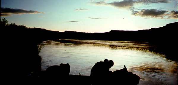
Idaho Paddler's Website: a supplemental resource for users of the book Guide to Idaho Paddling.
List of Rivers and Associated Topographic Maps
.
All the river segments covered in detail in Guide to Idaho Paddling are listed below in alphabetical order by the river name. Along with each river are the associated 7.5 minute United States Geological Survey Topographic Maps. All maps are Idaho maps, unless indicated otherwise. Note that the page numbers are for the revised edition of the book.
Additional Notes: In the new revised edition of Guide to Idaho Paddling, we didn't include a list of topo maps associated with each paddling trip. We used the space instead for more paddling trips, but if you'd like to have topo maps with you when paddling, we're including a list here.
(Note also that at one time we also distributed map booklets of selected rivers. The booklets were essentially US Geological Survey topo maps reproduced at scale and overlayed with our paddling notes. Since the maps we include in the book are fairly detailed, there hasn't been much of a demand for them. However, we recently created a series of North Idaho map booklets to supplement the book, and we may try to resurrect map booklets from other parts of the state some time in the future. We'll announce it here if and when they are available.)
Where to Obtain the following 7.5 Minuete Maps . . .
.
You can download PDF's of the following maps from: USGS Map Site
Page numbers, below, are for the revised edition of Guide to Idaho Paddling.
Bear River (Gentile Valley & Oneida Reservoir)
(Guide to Idaho Paddling: Page 35)
Grace Power Plant
Thatcher
Thatcher Hill
Oneida Narrows Reservoir
Bear River (Georgetown to Soda Springs)
(Guide to Idaho Paddling: Page 31 & 33)
Alexander
Fossil Canyon
Georgetown
Nounan
Soda Peak
Soda Springs
Bear River (Oneida Narrows Whitewater Run)
(Guide to Idaho Paddling: Page 37)
Oneida Narrows Reservoir
Treasureton
Riverdale
Bear River (Mink Creek to Utah Border)
(Guide to Idaho Paddling: Page 43)
Banida
Riverton
Weston
Big Lost River
Harry Canyon
Billingsley Creek
(Guide to Idaho Paddling: Page 147)
Hagerman
Blackfoot River (Below Blackfoot Reservoir)
(Guide to Idaho Paddling: Page 57)
Dunn Basin
Grizzly Creek
Meadow Creek Mtn
Miner Creek
Paradise Valley
Reservoir Mtn
Blackfoot River (Blackfoot Management Area and the Blackfoot Narrows)
(Guide to Idaho Paddling: Page 49 & 53)
Lower Valley
Upper Valley
Boise River (Discovery Park to Ann Morrison)
(Guide to Idaho Paddling: Page 205 & 207)
Lucky Peak
Boise South
Boise River (Ann Morrison to Glenwood)
(Guide to Idaho Paddling: Page 213)
Boise South
Boise North
Eagle
Boise River (Eagle Island: Glenwood to Star)
(Guide to Idaho Paddling: Page 217)
Eagle
Star
Boise River (Caldwell to Wilder)
(Guide to Idaho Paddling: Page 223)
Caldwell
Notus
Wilder
Boise River (Wilder to Snake Confluence)
(Guide to Idaho Paddling: Page 228 & 231)
Wilder
Parma
Owyhee, OR
Boise River, Middle Fork
(Guide to Idaho Paddling: Page 241)
Arrowrock NE
Twin Springs
Boise River, South Fork
(Guide to Idaho Paddling: Page 235)
Anderson Ranch Dam
Cathedral Rocks
Long Tom Reservoir
Bear Valley and Elk Creek
(Guide to Idaho Paddling: Page 191 & 195)
Bear Valley Mtn
Blue Bunch Mtn
Buffalo River
(Guide to Idaho Paddling: Page 105)
Island Park
Island Park Dam
Henrys Fork (Big Springs)
(Guide to Idaho Paddling: Page 109)
Big Springs
Island Park
Henrys Fork (Box Canyon)
(Guide to Idaho Paddling: Page 113)
Island Park Dam
Last Chance
Henrys Fork (Upper & Lower Harriman Park)
(Guide to Idaho Paddling: Page 115 & 118)
Last Chance
Henrys Fork (Riverside to Hatchery Ford)
(Guide to Idaho Paddling: Page 120)
Last Chance
Lookout Butte
Henrys Fork (Warm River to Ashton Reservoir)
(Guide to Idaho Paddling: Page 123)
Warm River
Ashton
Henrys Fork (Ashton Reservoir to Chester Dam)
(Guide to Idaho Paddling: Page 125)
Ashton
Lemon Lake
Little Salmon
(Guide to Idaho Paddling: Page 281)
Bally Mountain
New Meadows
Marsh Creek
(Guide to Idaho Paddling: Page 73)
Arimo
McCammon
Moyie River (Copper Campground to Twin Bridges)
Idaho Padder's Website: Link
Eastport
Meadow Creek
Moyie River (Twin Bridges to Meadow Creek Campground)
Idaho Padder's Website: Link
Meadow Creek
Payette River (Beehive Bend to Horseshoe Bend)
(Guide to Idaho Paddling: Page 245)
Dry Buck Valley
Horseshoe Bend
Payette River (Horseshoe Bend to Montour)
(Guide to Idaho Paddling: Page 249)
Horseshoe Bend
Montour
Payette River (Montour Wildlife Refuge)
(Guide to Idaho Paddling: Page 253)
Montour
Northeast Emmett
Payette River, Middle Fork
(Guide to Idaho Paddling: Page 261)
Pyle Creek
Garden Valley
Payette River, North Fork (Fisher Creek & the Meanders)
(Guide to Idaho Paddling: Page 265 & 269)
Granite Lake
McCall
Payette River, North Fork (Upper Long Valley)
(Guide to Idaho Paddling: Page 271)
McCall
Meadows
No Business Mtn
Lake Fork
Payette River, North Fork (Lower Long Valley)
(Guide to Idaho Paddling: Page 279)
Alpha
Cascade
Payette River, South Fork (Garden Valley)
(Guide to Idaho Paddling: Page 257)
Garden Valley
Banks
Portneuf River (Upper River to Pebble Bridge)
(Guide to Idaho Paddling: Page 63 & 65)
Chesterfield
Bear Camp Gulch
Haystack Mtn
Bancroft
Portneuf River (Lava Hot Springs area)
(Guide to Idaho Paddling: Page 67)
Lava Hot Springs
Haystack Mtn.
Portneuf River (City of Pocatello Run)
(Guide to Idaho Paddling: Page 71)
Pocatello North
Pocatello South
Michaud
Priest River (Outlet to Dickensheet)
Idaho Padder's Website: Link
Outlet Bay
Priest River (Dickensheet to Big Hole - Chipmunk Stretch)
Idaho Padder's Website: Link
Outlet Bay
Coolin
Prater Mountain
Quartz Mountain
Priest River (Big Hole to McAbee)
Idaho Padder's Website: Link
Quartz Mountain
Prater Mountain
Priest River (McAbee to Priest River Park)
Idaho Padder's Website: Link
Prater Mountain
Laclede
Priest River
Salmon Falls Creek Overnight Trip
(Guide to Idaho Paddling: Page 137)
Jackpot, Nevada
Meteor
Browns Bench South
Salmon Falls Creek (Lower - Balanced Rock Trip)
(Guide to Idaho Paddling: Page 150)
Balanced Rock
Salmon River (Redfish Area)
(Guide to Idaho Paddling: Page 175)
Stanley
Salmon River (Alturas Lake Cr. & Decker Flat)
(Guide to Idaho Paddling: Page 167 & 172)
Alturas Lake
Obsidian
Casino Lakes
Stanley
Salmon River (Challis Area)
(Guide to Idaho Paddling: Page 185)
Bradbury Flat
Challis
Ellis
Gooseberry Creek
Salmon River (Salmon City to Deadwater)
(Guide to Idaho Paddling: Pages 129-134)
Bird Creek
North Fork
Salmon
Ulysses Mtn
Salmon River (Stanley Scenic Float)
(Guide to Idaho Paddling: Page 181)
Stanley
Casino Lake
East Basin Creek
Silver Creek
(Guide to Idaho Paddling: Page 159 & 161)
Gannett
Picabo
Snake River (Birds of Prey)
(Guide to Idaho Paddling: Page 199)
Sinker Butte
Initial Point
Walters Butte
Snake River (Blackfoot to American Falls)
(Guide to Idaho Paddling: Page 77 & 78)
Blackfoot
Moreland
Rockford
Pingree
Springfield
Snake River (Massacre Rocks & American Falls)
(Guide to Idaho Paddling: Page 81 & 83)
American Falls
American Falls SW
Neeley
Snake River (Palisades Dam to Heise)
(Guide to Idaho Paddling: Page 97 & 101)
Conant Valley
Heise SE
Palisades Dam
Poplar
Red Ridge
Swan Valley
Wheaton Mtn
Snake River (Shoshone Falls Scenic Trip)
(Guide to Idaho Paddling: Page 141)
Twin Falls
Snake River (Thousand Springs Scenic Paddle)
(Guide to Idaho Paddling: Page 153)
Thousand Springs
Tuttle
Hagerman
Teton River
(Guide to Idaho Paddling: Pages 85-94)
Bates
Tetonia
Valley Creek
(Guide to Idaho Paddling: Page 185)
Elk Meadow
Stanley
Stanley Lake